How to Read a Topographic Map
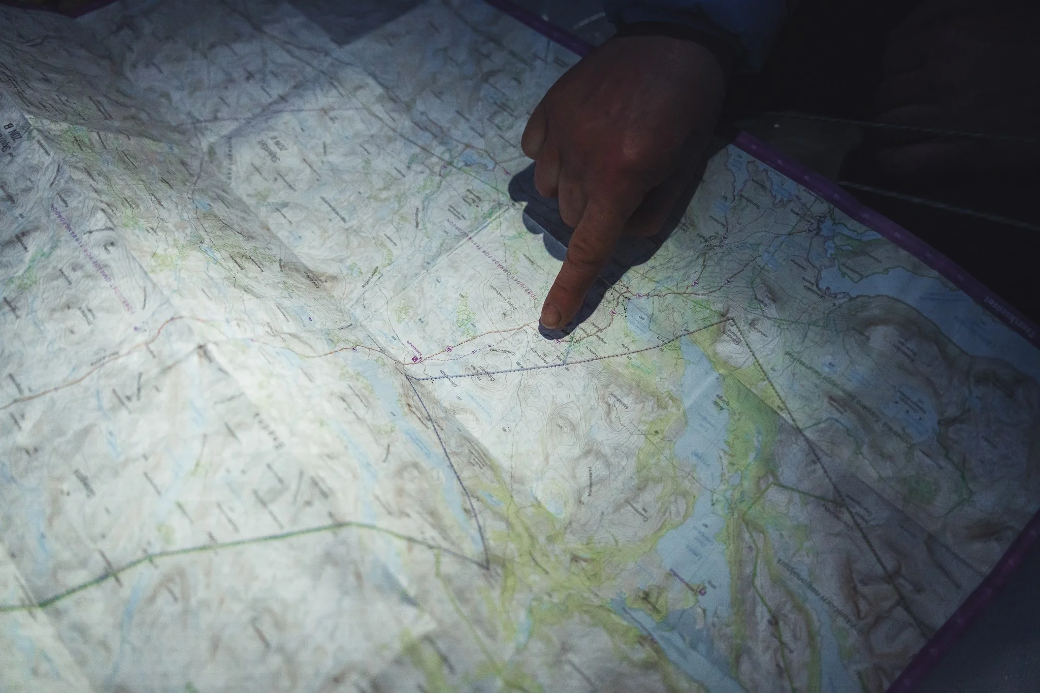
In today's world of GPS devices and smartphone navigation apps, many outdoor enthusiasts overlook one of the most valuable wilderness skills—reading a topographic map. Batteries die, signals disappear, and electronics can fail when you need them most. Knowing how to interpret a topographic map gives you confidence, improves your navigation skills, and helps you make safer decisions in the back country.
Whether you're hiking, backpacking, hunting, or camping, understanding a topo map is an essential outdoor skill.
What Is a Topographic Map?
The Map
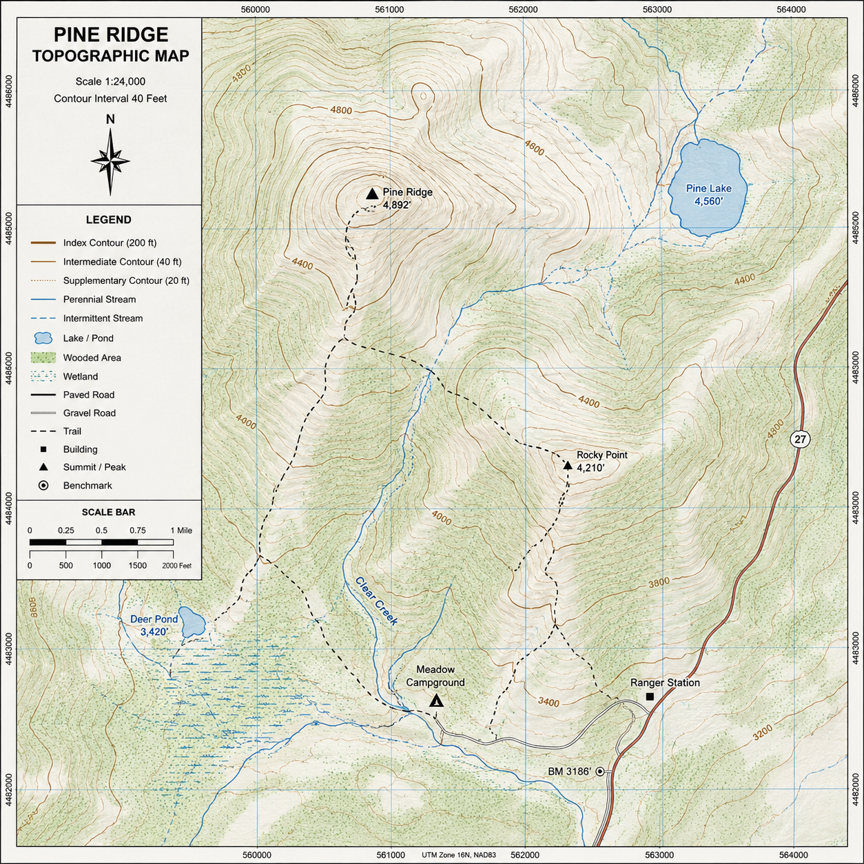
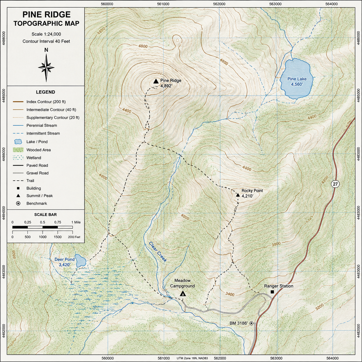
A topographic map is a detailed representation of the terrain. Unlike a standard road map, it shows the shape and elevation of the land using contour lines, along with natural and man-made features such as rivers, lakes, trails, roads, campsites, and peaks.
These maps allow you to visualize the landscape before you ever set foot on the trail.
lines, lines, lines!
Understanding Contour Lines
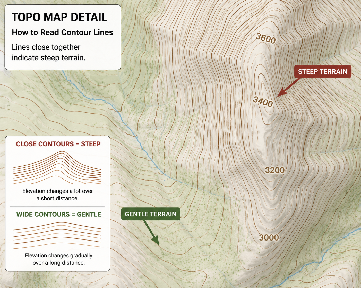
Contour lines are the foundation of every topographic map. Each line connects points of equal elevation.
Here are the basics:
Lines close together indicate steep terrain.
Lines spaced far apart represent gentle slopes or flat ground.
Closed circles often indicate hills or mountain summits.
V-shaped contours usually point upstream when crossing rivers or valleys.
The elevation difference between contour lines is called the contour interval, which is listed in the map legend. For example, a 40-foot contour interval means each line represents a 40-foot change in elevation.
What are those symbols?
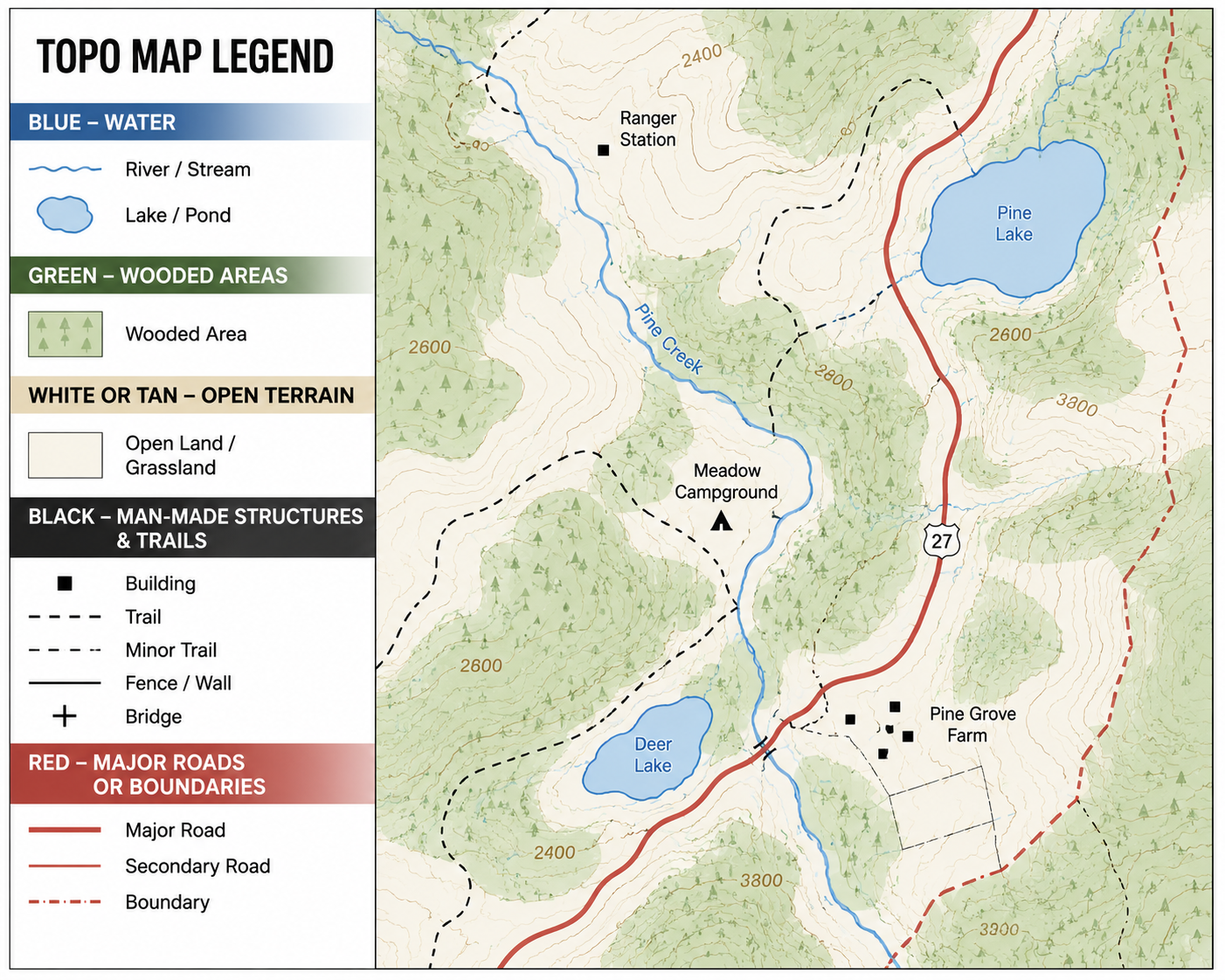
Learn the Symbols
Every topographic map includes a legend explaining its symbols. While symbols may vary slightly between map publishers, common features include:
Blue for water sources such as rivers and lakes
Green for wooded areas
White or tan for open terrain
Black for man-made structures and trails
Red for major roads or boundaries
Taking a few minutes to study the legend can save hours of confusion in the field.
Where Am I heading?
Make it stand out
Whatever it is, the way you tell your story online can make all the difference.
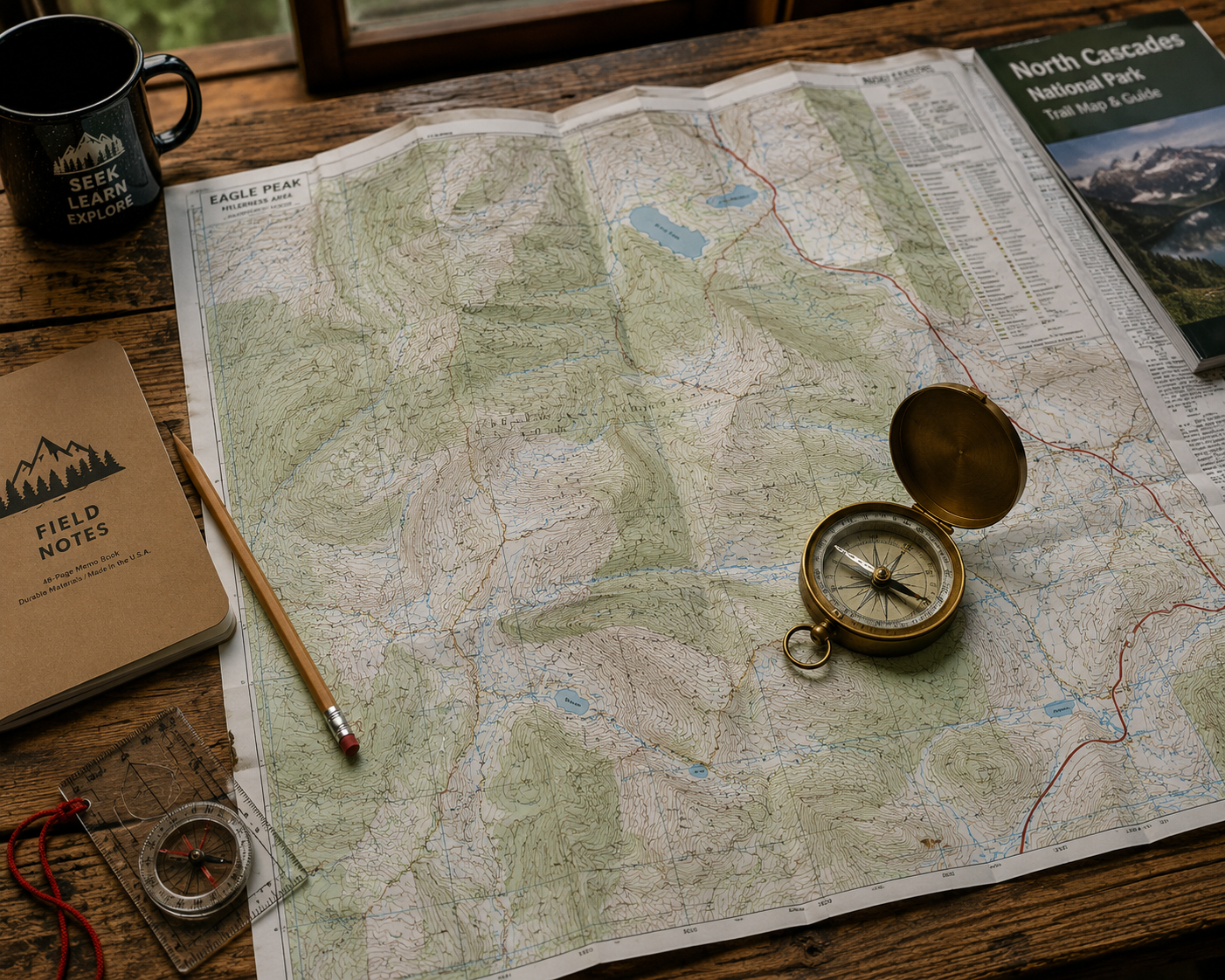
A map is only useful if you know which way you're facing.
Always orient your map using a compass before navigating. Align the map's north with magnetic north and identify your current location. From there, you can determine your route, nearby landmarks, and potential hazards.
Learning to use a compass alongside a topographic map is one of the most valuable navigation skills any adventurer can develop.
How far and how high am I climbing?
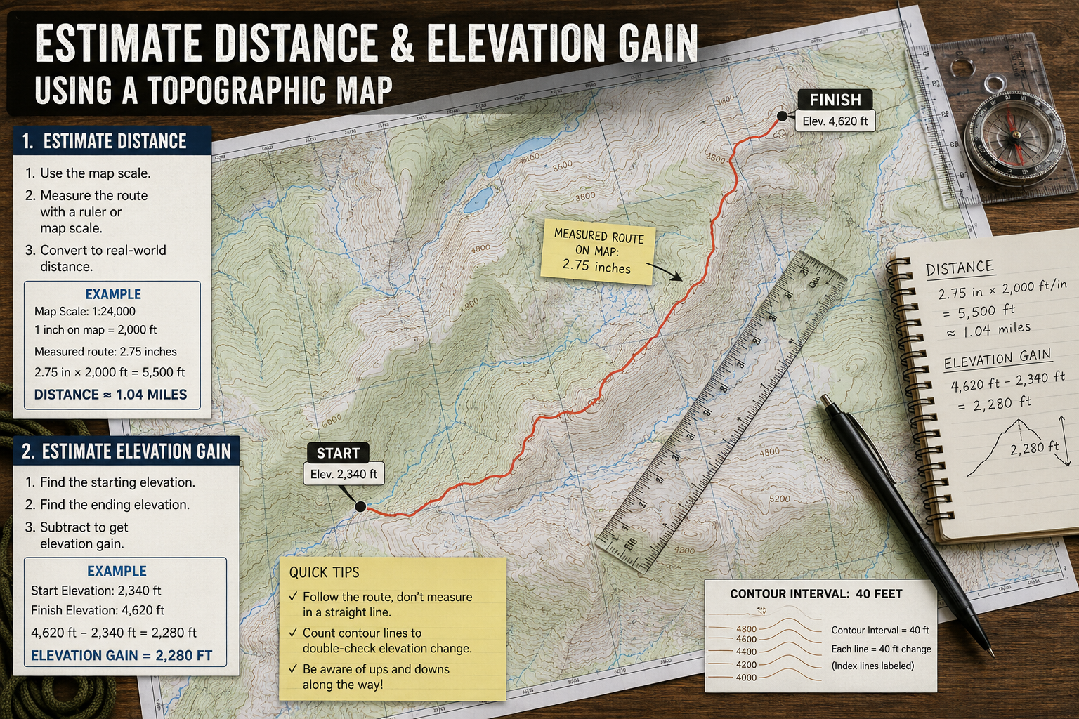
Estimate Distance and Elevation Gain
Every map includes a scale that allows you to measure distance.
Keep in mind that trail distance isn't the only factor affecting difficulty. A two-mile hike with 2,000 feet of elevation gain is far more demanding than a flat two-mile walk.
By studying contour lines before your trip, you can anticipate steep climbs, ridges, saddles, and valleys, helping you plan realistic hiking times and conserve energy.
Practice Before You Go and must of all DO not get Lost
Like any outdoor skill, map reading improves with practice. Bring a printed topographic map on local hikes, even if you're using GPS. Compare what you see on the ground with what appears on the map. Soon you'll recognize terrain features almost instinctively.
The more familiar you become with topographic maps, the more confident you'll feel exploring new places.
Technology is an incredible tool, but it should never replace fundamental navigation skills. Learning how to read a topographic map gives you a deeper understanding of the landscape, improves trip planning, and provides a dependable backup when electronics fail.
Before your next adventure, spend a little time studying your map. The knowledge you gain today could make tomorrow's journey safer, more enjoyable, and far more rewarding.